Doing science underwater is part logistics, part safety, part data discipline. Projects have narrow weather windows, strict permit conditions, and exact protocols for sampling and measurement. The right team blends scientific method with marine operations, so your campaign hits its objectives and your data stands up to peer, regulator, or funder review.
Nautrex providers support the full lifecycle. In planning, they help refine objectives into practical methods (transects, quadrats, photogrammetry, mark-recapture, telemetry), choose suitable platforms (divers, ROV/AUV, or hybrid), and design HSE plans tailored to site conditions. They advise on permissions (parks, sanctuaries, cultural heritage), protected-species rules, and chain-of-custody requirements for lab samples.
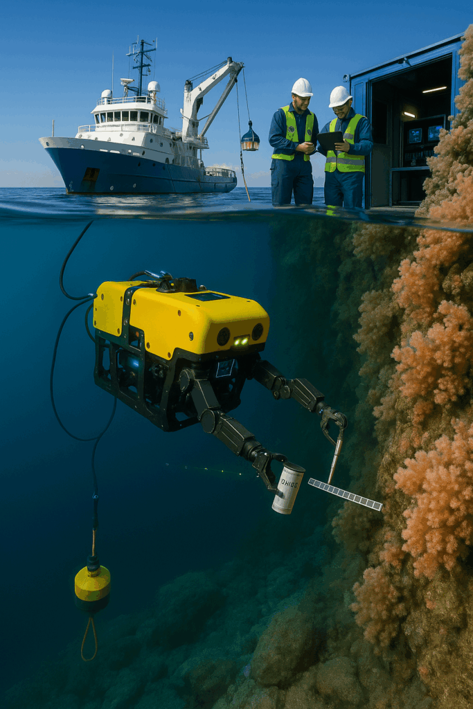
On deployment, teams mobilize vessels, divers, and robotic platforms; set up moored instruments (ADCPs, CTDs, hydrophones), pulls and recoveries; run benthic and pelagic surveys; collect water/sediment samples; and capture calibrated stills/video for analysis. Where visibility, depth, or endurance are limiting factors, AUVs extend coverage with autonomous lines while ROVs deliver close-up inspections and manipulator work.
For data and reporting, crews provide clean metadata (time, depth, GPS), QC notes, and media logs. Deliverables can include GIS-ready layers, photomosaics, species counts, and summary dashboards, plus packaged datasets for labs or archives. Throughout, operations follow documented dive plans, JSAs, risk assessments, and environmental controls that match permit language, so approvals move faster and re-work risk stays low.
With Nautrex, you can compare vetted research partners by scientific focus, equipment spread, and regional experience—then hire the team that fits your objectives, timeline, and budget, all inside the platform.