Loading...

Marine Archaeology

Certified maritime archaeology teams for remote sensing, site recording, photogrammetry, impact assessments, permitted excavation/recovery, conservation, and long-term monitoring. Hire vetted specialists who protect cultural heritage while keeping marine works compliant, ethical, and on schedule.

Remotely operated vehicle and diver investigating a shipwreck site while a research vessel deploys equipment from a crane, illustrating a large-scale offshore marine archaeology operation.
Home Services Marine Archaeology

Trusted Marine Archaeology for Heritage Protection & Marine Works

Underwater cultural heritage demands scientific rigor and legal compliance. The right partner blends archaeological method with marine operations, so surveys and interventions meet heritage-authority conditions without delaying port, cable, dredging, or coastal projects. Providers start by aligning with your scope—research surveys or development-led archaeology—and drafting a method statement that covers legislation, permits, HSE, Indigenous/community liaison, chance-finds protocols, and reporting pathways.

For discovery and mapping, teams acquire side-scan, multibeam, and magnetometer data, then ground-truth anomalies with divers or ROVs. Baseline documentation uses scaled plans, context sheets, and 3D photogrammetry to capture structure and artifact relationships in situ. Where intervention is permitted, archaeologists execute test trenches or limited recoveries, stabilize and pack finds, and transfer them to accredited conservators under chain-of-custody—favoring in-situ preservation wherever possible.

On construction and maintenance projects, specialists deliver cultural-heritage impact assessments, method statements, and watching briefs that keep works moving: they set exclusion zones, brief contractors, monitor excavation windows, and adapt mitigation in real time. For long-term stewardship, they design site protection and condition-monitoring regimes to deter looting and track erosion or biofouling over time.

Deliverables are built for approvals and archives: GIS layers, target lists, photo-mosaics, 3D models, context logs, conservation recommendations, and concise reports mapped to authority templates. Through Nautrex, you can compare vetted maritime archaeology providers by permits history, equipment spread (ROV/sonar/photogrammetry), museum partnerships, and regional experience—then request structured proposals and keep procurement inside the platform, consistent with your Service×Location SEO funnel.

Specialized Capabilities

Sub-Services Under Marine Archaeology

Remote Sensing & Target Verification

Acquire side-scan, multibeam, and magnetometer data, then ground-truth anomalies with divers or ROVs to locate and classify sites.

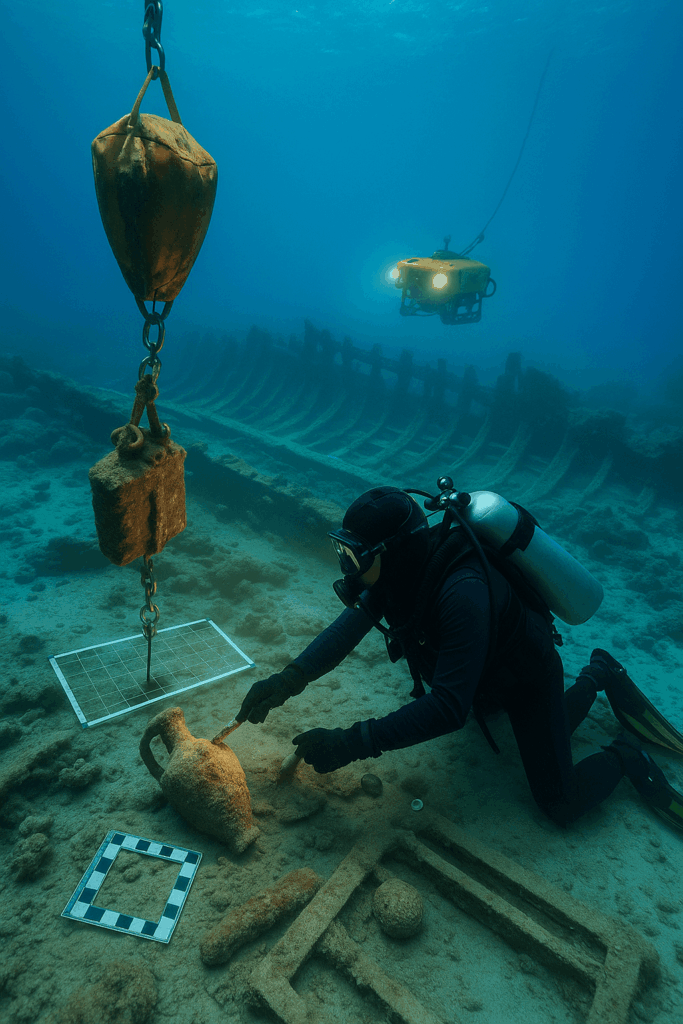
Baseline Recording & Photogrammetry

Produce scaled plans, 3D models, and context logs to document structures and artifacts in situ with repeatable accuracy.

Excavation, Recovery & Conservation (Permitted)

Undertake limited test excavations or recoveries where licensed, stabilize finds, and route them to accredited conservation labs.

Impact Assessment & Watching Briefs

Prepare heritage impact assessments, mitigation plans, and on-site monitoring that let dredging, cable, or quay works proceed safely.

Permits, Ethics & Stakeholder Liaison

Navigate heritage law and permissions, coordinate with authorities and communities, and deliver compliant reports and archives.

Site Protection & Condition Monitoring

Install protective measures and run periodic surveys to deter interference and track change from storms, currents, or biofouling.

Recent Projects in Marine Archaeology

Connecting You to the World of Marine Services

From discovery surveys to conservation plans, Nautrex helps you hire maritime archaeology teams and find the right experts for any site—all in one platform.